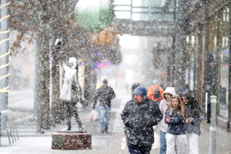
Winter storm sweeps into Great Lakes area

Heavy snow falls along Nicollet Mall Sunday Dec.28, 2025 in Minneapolis. (Jerry Holt /Star Tribune via AP)
High winds,
heavy snow
for the Valley
The National Weather Service on Sunday night issued weather advisories for Trumbull and Mahoning counties through 1 a.m. Tuesday.
In Trumbull County, up to 7 inches of snow is forecast with wind gusts up to 50 mph predicted.
In Mahoning County, less snow is forecast but wind gusts may reach as high as 55 mph.
*
A powerful winter storm was sweeping east from the Plains on Sunday, driven by what meteorologists describe as an intense cyclone that is taking aim at much of the country with a mixture of snow, ice, rain and strong winds.
“Part of the storm system is getting heavy snow, other parts of the storm along the cold front are getting higher winds and much colder temperatures as the front passes,” said Bob Oravec, a lead forecaster at the National Weather Service office in College Park, Maryland. “They’re all related to each other — different parts of the country will be receiving different effects from this storm.”
Snow and strengthening winds spread Sunday across the Upper Midwest, where the National Weather Service warned of whiteout conditions and possible blizzard conditions that could make travel impossible in some areas. Snowfall totals were expected to exceed a foot (30 centimeters) across parts of the upper Great Lakes, with up to 2 feet (60 centimeters) possible along the south shore of Lake Superior.
Waves on Lake Superior will likely top 25 feet by dawn today, with towering waves also projected for the other Great Lakes, forecasters said.
“Since the infamous Edmund Fitzgerald storm in ’75, we’ve had zero major incidents on the lake,” said Ben Warren, a National Weather Service meteorologist in Marquette, Michigan.
Forecasts have improved substantially since 29 people perished when the Edmund Fitzgerald iron ore freighter was swallowed by Lake Superior on Nov. 10, 1975.
The weather service had forecast waves of up to 16 feet shortly before the Edmund Fitzgerald sank.
The National Weather Service warned of “dangerous wind chills” as low as minus 30 degrees Fahrenheit in North Dakota and into Minnesota from Sunday night into Monday.
In the South, meteorologists warned of severe thunderstorms expected to signal the arrival of a sharp cold front — sometimes referred to as a “Blue Norther” — bringing a sudden plunge in temperatures and strong north winds that will end days of record warmth around the region.
The snowy holiday season in the Upper Midwest and Northeast comes as springlike warmth continued in much of the nation’s midsection and South amid record high temperatures.
The high temperature in Atlanta was around 72 F on Sunday, continuing a warming trend after climbing to 78 F to shatter the city’s record high temperature for Christmas Eve, the National Weather Service said. Numerous other record high temperatures were seen across the South and Midwest on the days after Christmas.
But that record heat is quickly coming to an end, forecasters say.
A cold front is expected to bring rain to much of the South late Sunday night into Monday, bringing much colder weather by Tuesday. The abrupt change will drop the low temperature in Atlanta to 25 F (minus 3.9 C) by early Tuesday morning. The colder temperatures in the South are expected to persist through New Year’s Day.
In Dallas, Sunday temperatures in the lower 80s could drop down to the mid 40s In Little Rock, high temperatures of around 70 degrees on Sunday could drop down to highs in the mid-30s today.
“We’re definitely going back towards a more winter pattern,” Oravec said.
Over the next 48 hours, the cyclone is expected to produce heavy snow and blizzard conditions in the Midwest and Great Lakes, freezing rain in New England, thunderstorms across the eastern U.S. and South, and widespread strong winds.
The storm is expected to intensify as it moves east, drawing energy from a sharp clash between frigid air plunging south from Canada and unusually warm air that has lingered across the southern United States, according to the National Weather Service.
It follows thousands of flight delays and cancellations across the Northeast and Great Lakes regions earlier this weekend due to snow, as thousands took to the roads and airports during the busy travel period between Christmas and New Year’s. Delays and cancellations continued Sunday.
On the other side of the country, California was experiencing a fairly dry weekend after powerful storms battered the state with heavy rains, flash flooding and mudslides.


